- Search
- connect with us
-


Every year, the Goodyear Towpath Treks guides visitors along four different sections of National Heritage Canalway to celebrate continuing developments, admire its autumn beauty, and to discover the natural, historical, and recreational resources the Canalway has to offer! Everyone is invited to hike or bike these sections between September 1st and November 30th, 2023. This is a great opportunity to get active and to learn more about different areas in the Ohio and Erie Canalway Heritage Area.
2023 Highlighted Trail Sections
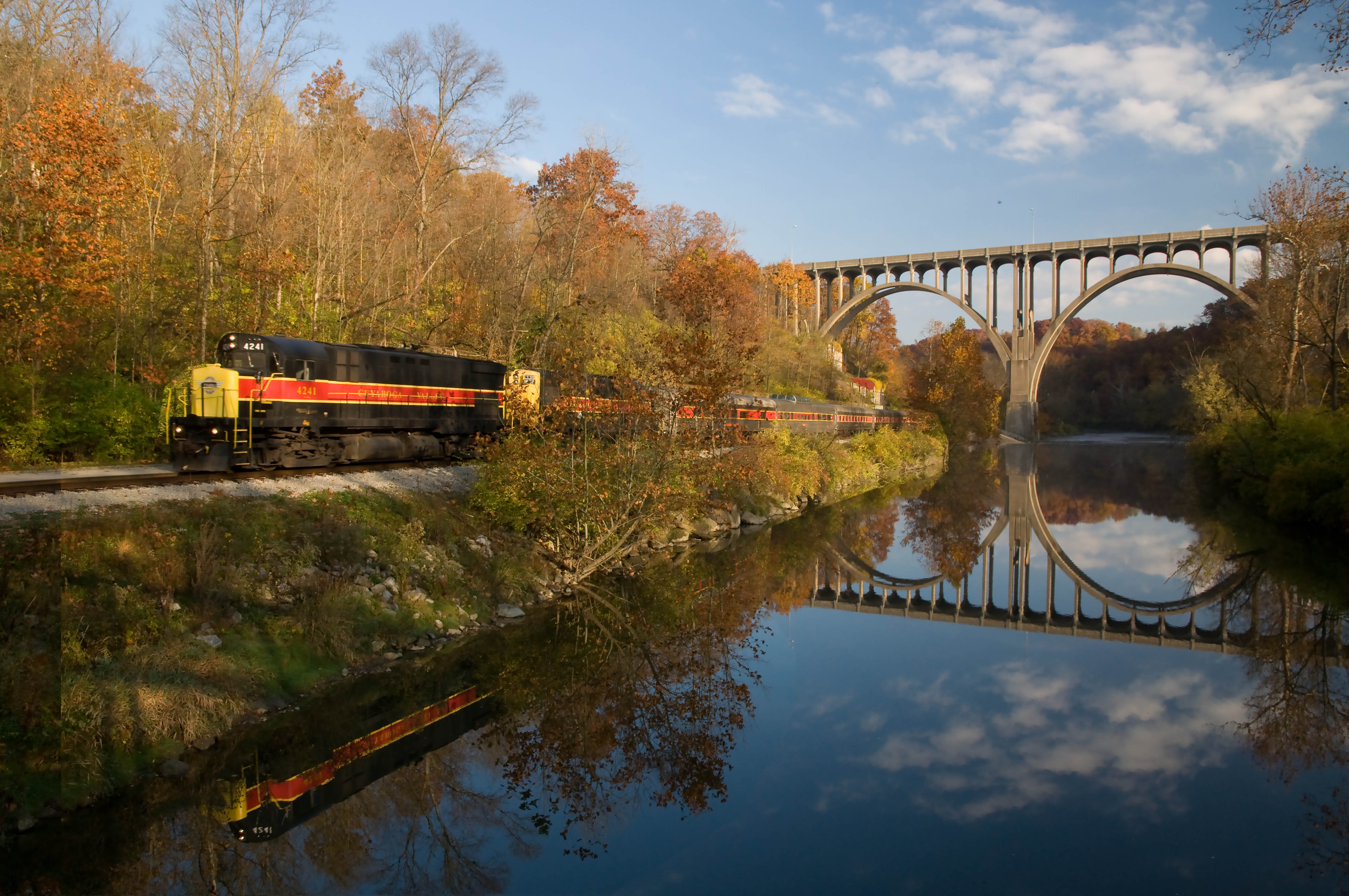
Lock 39 to Canal Exploration Center (Cuyahoga County, 3.5 miles roundtrip)
Lock 39 is one of many historical remnants of the Ohio and Erie Canal, and is considered the gateway to the Cuyahoga Valley National Park to the south and the Cleveland Metro parks to the north. The Rockside station for the Cuyahoga Valley Scenic Railroad lies just west of the Lock 39 trailhead, across the Cuyahoga River, but is not boarding at this station due to repair work. Don’t worry, visitors can still enjoy their 2-hour scenic excursions by boarding at the Peninsula and Akron Northside stations.
Courtesy of Tom Jones
The Ohio & Erie Canal Reservation is managed by Cleveland Metro Parks, and follows a portion of its namesake, the Ohio & Erie Canal. Together with the Cuyahoga River, the northernmost remaining 4.4 miles of watered canal provides wildlife management areas, fishing opportunities and scenic beauty. Picnicking, hiking trails, a 7.2-mile All Purpose Trail, and unique natural and cultural heritage of this valley are also featured in this reservation.
Courtesy of Cuyahoga Valley Scenic Railroad
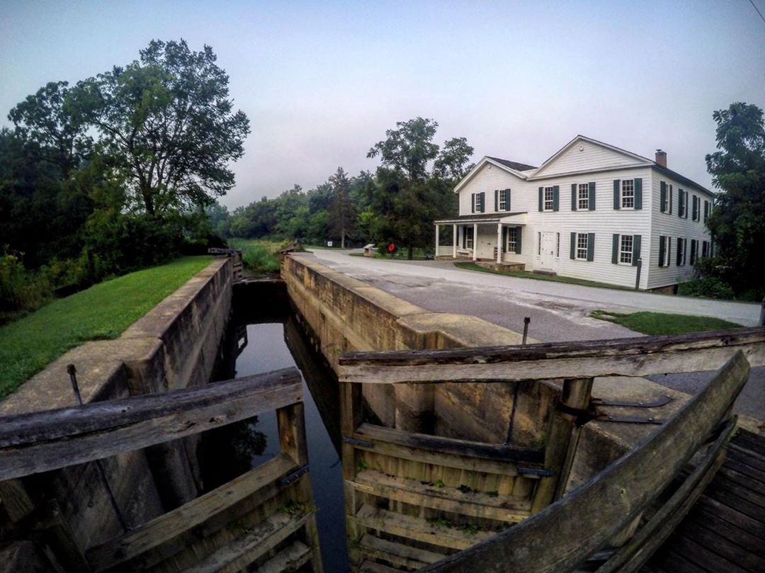
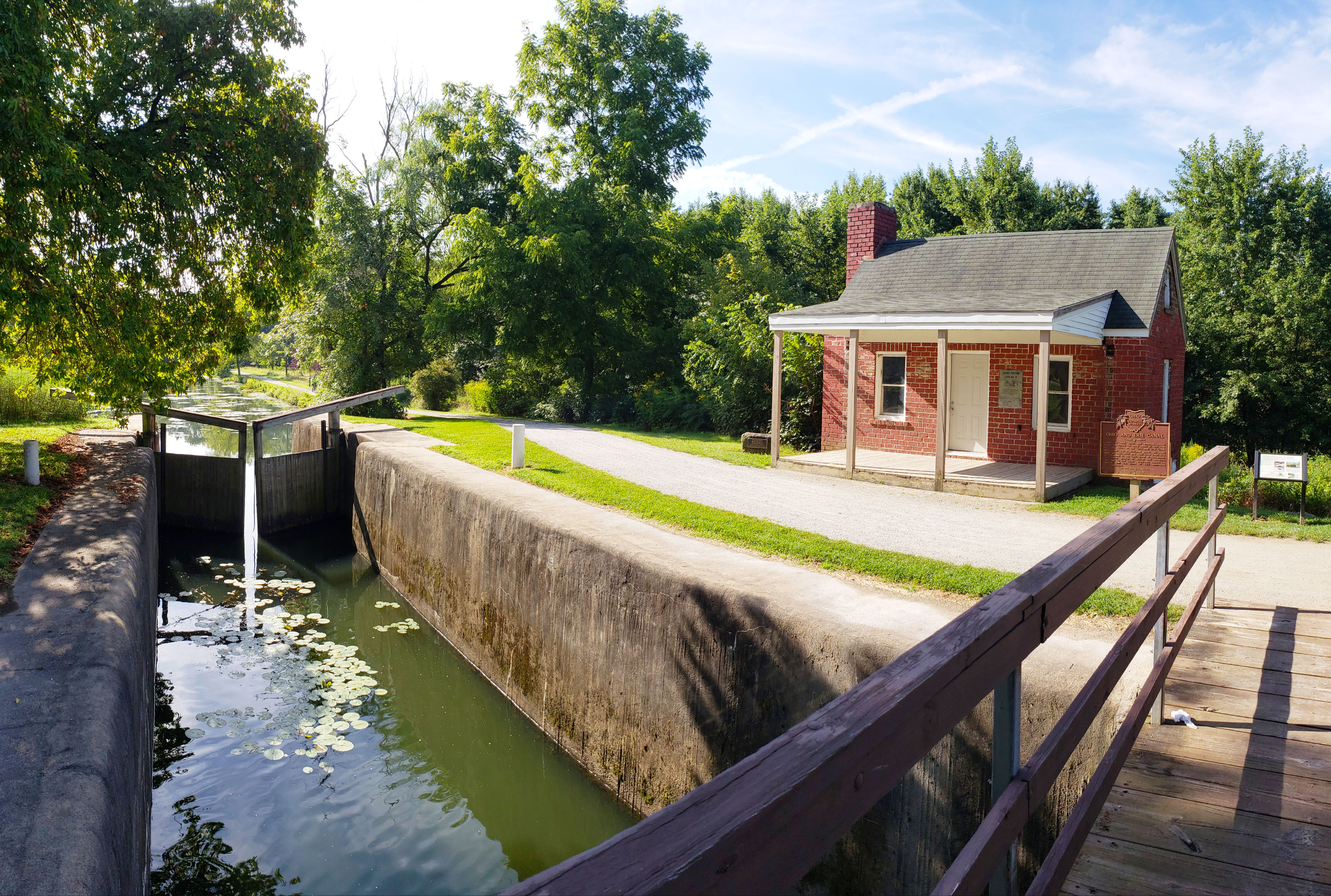
Once a tavern, store, and residence, the Canal Exploration Center now acts as an interactive location to explore the hey-day of the Ohio and Erie Canal. Maps, games, and experiences from people who lived and worked along the canal allow visitors to immerse themselves in the history of the watery highways. Outside the exploration sits Lock 38, also called the “Twelve Mile Lock,” which is the last functioning lock remaining along the 90-mile continuous trail.
Summit Lake to Wilbeth Road (Summit County, 2.8 miles roundtrip)
Summit Lake is a beautiful glacial lake and the high point (summit) along the Ohio & Erie Canal and a continental divide. Once part of a transportation route for indigenous groups, an amusement area, and wastewater area from Akron's industrial era, the lake is now a wildlife and recreational hotspot along the Towpath Trail.
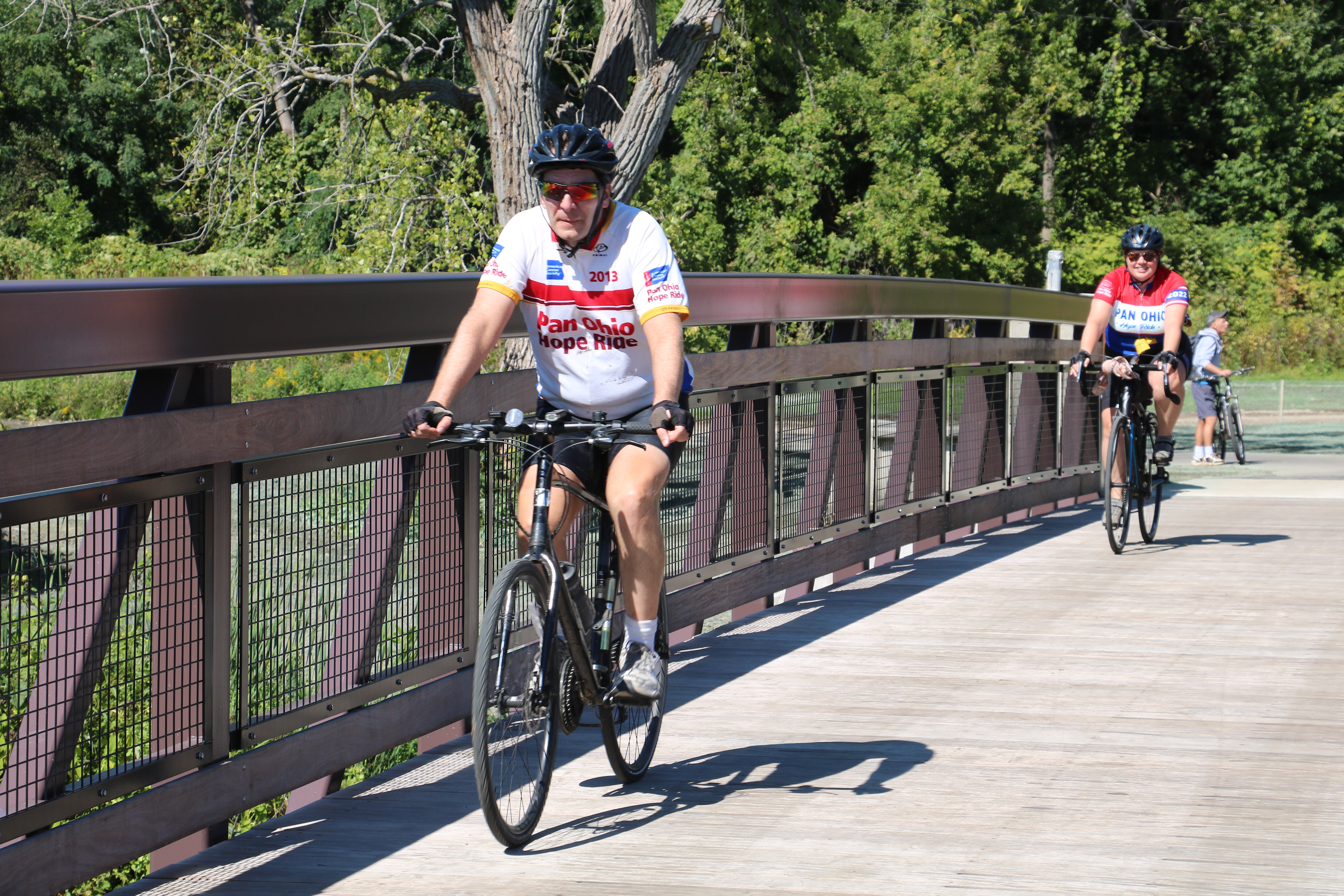
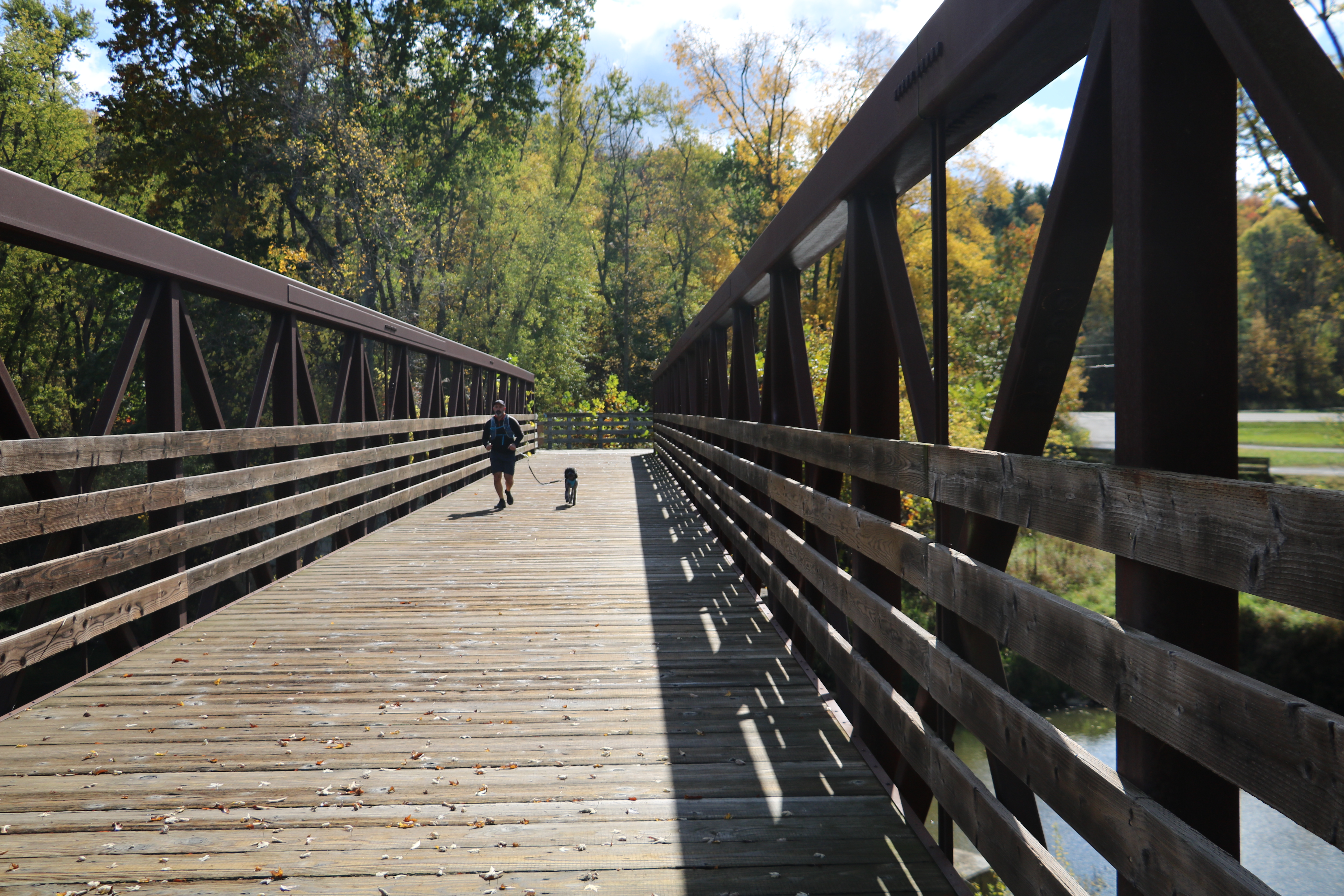
The exciting addition of the Ohio and Erie Canal Summit Lake Trail, which connects the Summit Lake east and west neighborhoods directly to the Towpath Trail, is now open and accessible to the public. The trail loops around the entire lake for 2.75 miles, showcasing various perspectives of its natural beauty and native wildlife. More developments along the lake’s north shore will continue as part of the Summit Lake Vision plan in 2024.
Summit Lake North Shore Bridge; Courtesy of Ohio & Erie Canalway Coalition
Courtesy of the City of Akron
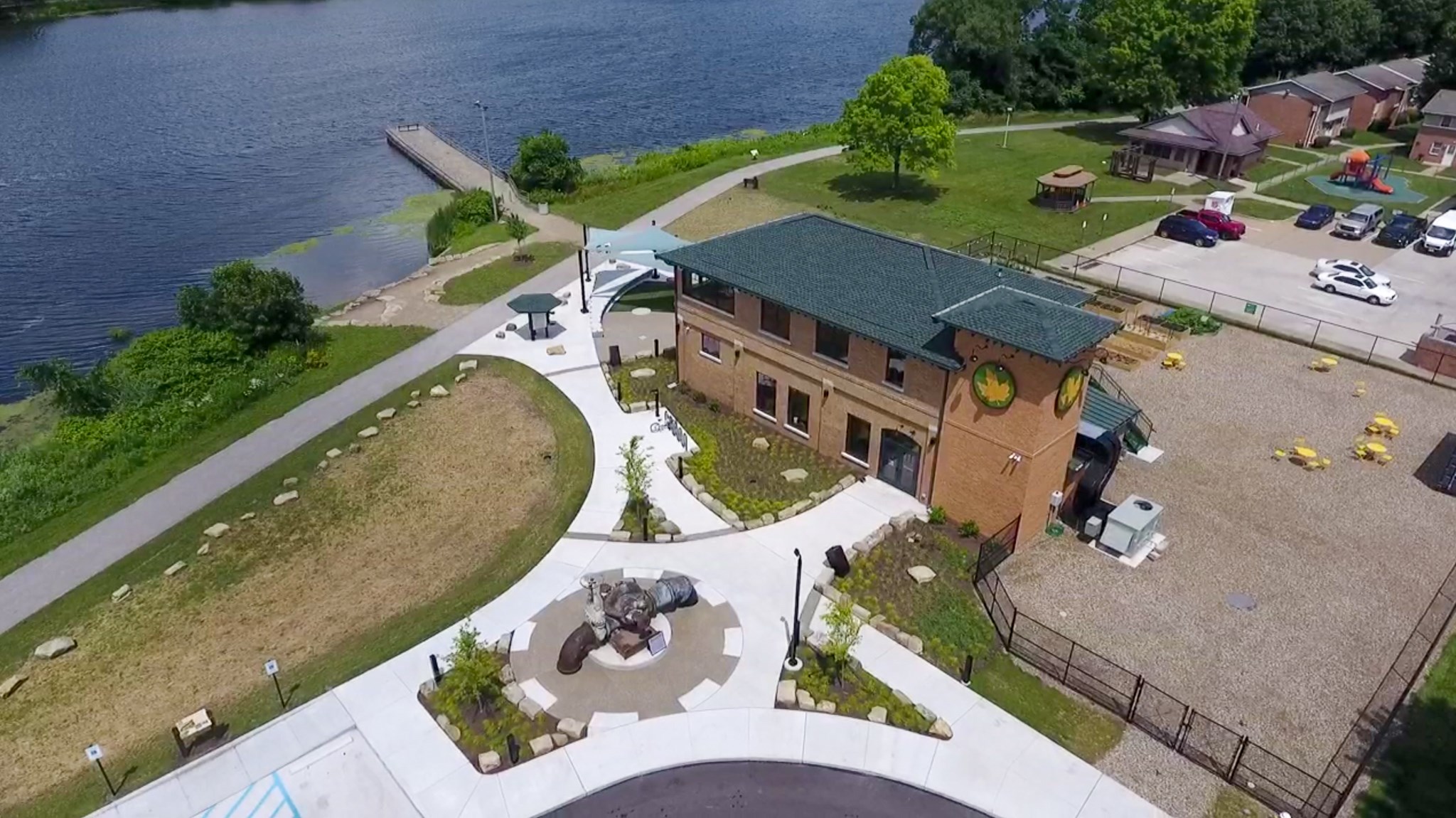
The Summit Metro Parks Summit Lake Nature Center provides exhibits and programming focused on wildlife education, urban gardening, and water-based recreation, and resides within the old pump house used by industrial factories to pump water from the lake.
The Reach Opportunity Center is another important landmark along the lake. This community hub provides a variety of services and events such as childhood education, youth programs, workforce development, workshops, support groups, and much more.
St. Helena Heritage Park to Lock 4 (Stark County, 2 miles roundtrip)
St. Helena Heritage Park is located near downtown Canal Fulton. Canal Fulton came to be as a result of the Ohio & Erie Canal back in the 1800s. After merging with surrounding communities, the main commercial activity of the city served canal traffic and exported farm produce. The canal era did end in 1869 when railroads were introduced and caused economic decline in the community, but it remained afloat due to coal mining. Today, Canal Fulton is an education, transportation, and retail center for Stark County.
Courtesy of Fitzwater Photography
Lock 4 hosts another historic lock gate structure in addition to other canal remnants, including a mill raceway and replica of the lock tender’s house. Lock 4 is also a relaxing recreational area, holding picnic grounds with grills as well as being a favored fishing spot since the 1800’s. Just east of Lock 4 is Sluggers and Putters Amusement Park. What use to be a cornfield, Sluggers and Putters offers a wide range of family fun activities including mini golf, go-karts, rides, and much more.
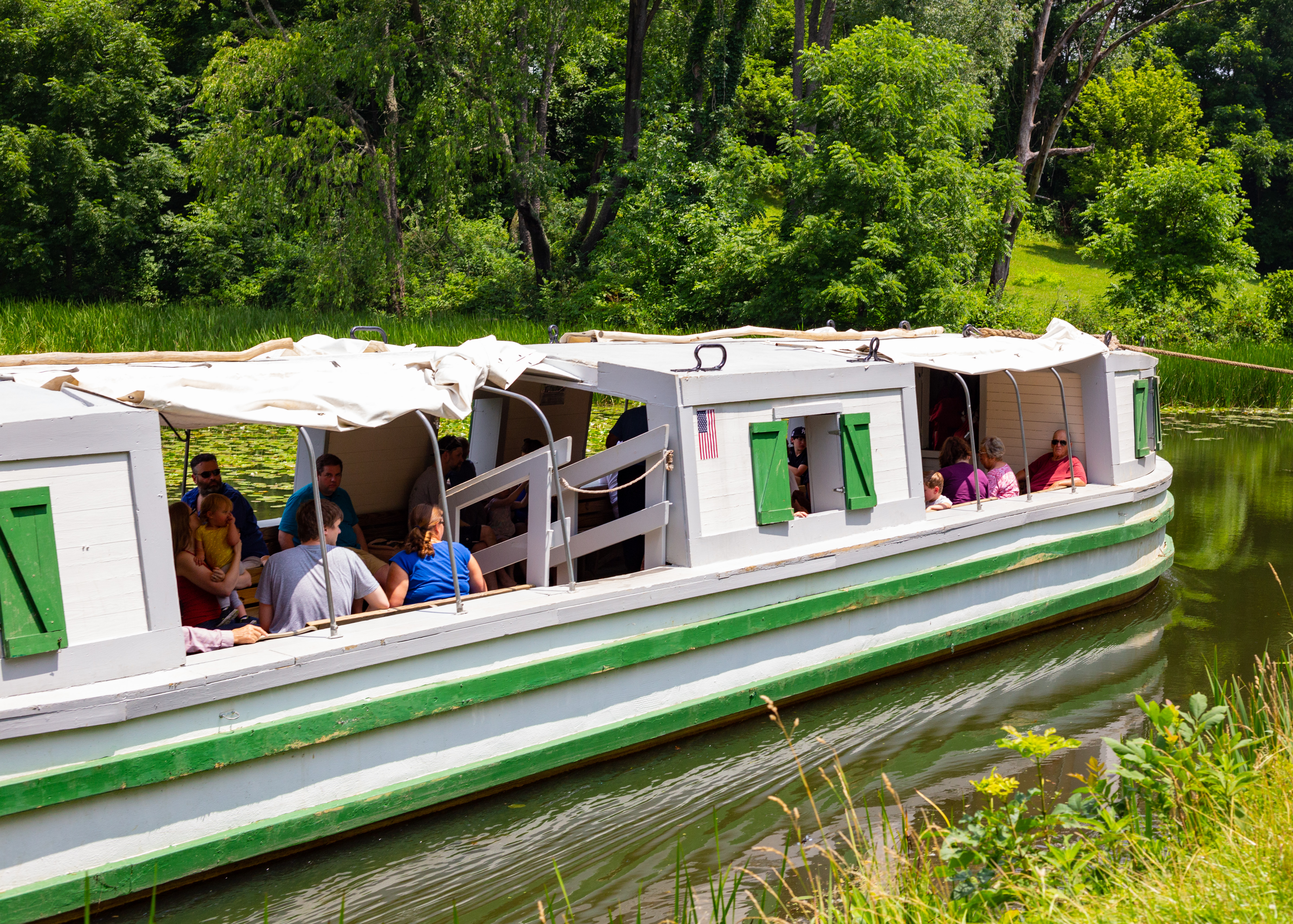
More historical information about the city can be found at the seasonal Canal Fulton Canalway Center, which resides in the St. Helena Heritage Park. The center is also the only part of the heritage area where you have the opportunity to ride a canal boat! Pulled by two horses, St. Helena III is a replica freighter canal boat that takes visitors on a one-hour ride through the canal as a historian gives insight into the history of the Ohio and Erie Canal and surrounding areas.
Courtesy of Katelyn Freil
Canal Bend to McDonnell (Tuscarawas County, 2.3 miles roundtrip)
This section of the trail is quiet and rural, featuring peaceful tree lines and open fields. The section lies just west of the historic Village of Bolivar, called the “Gateway to Tuscarawas County”.
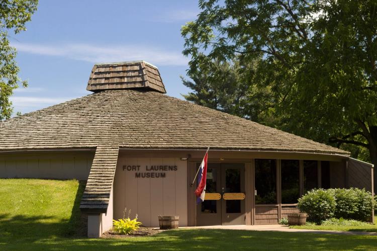
The village is a towpath community which features the only Revolutionary War fort in Ohio, Fort Laurens. This former wilderness outpost, built in 1778, holds a museum which tells the stories of soldiers on the frontier. The site also is home to the Tomb of the Unknown Patriot of the American Revolution, which pays homage to the unknown defenders stationed at the fort.
Courtesy of Tusc Parks
The fort originally served three purposes: act as a base to attack a Detroit-based British Garrison, deter British-loyal Native Americans from raiding American settlers in the region, and to offer protection to the Christian Delawares, an indigenous native population, in hopes of convincing them to join their side. While none of the original fort remains, the outline is still visible.
Courtesy of Ohio & Erie Canalway Coalition
The McDonnell trailhead features the Aqueduct Bridge, an important link that connects Tuscarawas County to the rest of the Ohio and Erie trail. The bridge sits on the site of a bygone wooden aqueduct that helped carry canal boats over the Tuscarawas River in the 1800s. Also near the trailhead is Towpath Trail Peace Park and Cedar Crest Farm. Towpath Peace Park is a primitive camping area with friendly amenities such as fire pits and picnic tables.
Cedar Crest Farm was originally designed as a dairy farm during the 19th century, but was later converted into a beef and grain farm. The farm offers a wide variety of different events and attractions at different times during the year, including corn mazes, live animals, sunflower patches, hayrides, seasonal photography sessions, and more.